Ingo Noka

Posts Tagged ‘radio’

Two Countries in Ten Minutes

In Flight Bag, Knowledge, Navigation on April 7, 2013 at 9:55 pm

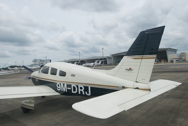
9M-DRJ in its parking spot at Seletar Airport (Compact Parking A2)

5 April 2014: Note that for flights between Seletar and Senai airport the first reporting point in Malaysia after Point X-Ray is not the small hill (East of JB town) anymore.  The new reporting points are now Tebrau City Mall and Felda Ulu Tebrau. I have updated my VFR reporting point files (click here)  and you can also have a preview on Google Maps (click here).

1 May 2013: Updated the process to file general declaration forms for departure.  It is now necessary to bring three GenDex forms to the Apron office.  Apron will keep two forms and hand back the third one with a big stamp on it that proves you have paid the passenger fee or that you do not have passengers.  The GenDex with the stamp need to be handed to the immigration officer.

Since I started to fly 9M-DRJ, which has a parking space in Singapore, Seletar airport, I routinely fly between Singapore and Johor.  The flight is very short (15 to 20 minutes) and I think it is pretty cool that you can hop over to Johor for a quick chat any time you want to.  Of course, flying to any other place in Malaysia is also more convenient.  The immigration and customs control in Seletar is very fast, friendly and efficient.  From leaving home (East Coast) to taking off can be accomplished in less than an hour.

Before I started flying from Seletar I heard stories about inflexible ATC procedures, but I have not experienced this.  Of course, safety is paramount, but within the confines of the procedures Seletar tower is very accommodating and flexible.  If they can make it happen without compromising security they will.  Just asked nicely and with proper radio protocol and you will be fine!

I only know ground operations West of the runway. The assumption in my post is that you will fly between Seletar and Senai airport. For Tioman and other directions over the Malaysian peninsular, just change the reporting points after “East of JB Town”.

Read the rest of this entry »

VFR Reporting Points

In Flight Bag, Navigation on February 10, 2013 at 10:33 pm

VFR Reporting Points on the Malaysian Peninsula

28 April 2013: Added waypoints along the east coast and two routes from KL to Kota Bahru.

In Malaysia ATC follows all VFR flights regardless of the classification of the airspace and pilots must submit a flight plan for all VFR cross-country flights.  This practice requires some common understanding of acceptable reporting points between VFR pilots and ATC.  Given the importance of reporting points for VFR flying in Malaysia, there is surprisingly little information and documentation about them.  As I have written in my post about the availability of aviation charts, there is no such thing as up-to-date sectional charts that could be used for flight planning and pilotage navigation.  for small parts of the airspace (Langkawi, Johor, Tioman, KL) I have tried to rectify this by drawing my own maps, but this is a very poor replacement for proper charts.

In addition to drawing my own charts, I have also collected reporting points I have used in my cross-country flying.  And with this post, I am going to share this information (download different versions here V1 V2 V3 V4 V5).  Most pilots own GPS devices and use them for navigational purposes.  Some devices or applications on the iPad or iPhone can import geographical points in certain formats, so I am providing the data in GPX format as well.  I am able to convert this file into other formats, so if you tell me what you need, I may be able to help.  I would certainly be interested in hearing if you have been successful in using the file with your GPS device or application.  I do know for certain that the file can be imported into Google Maps and into the MotionX GPS application on the iPad and iPhone.

Read the rest of this entry »

Subang live updates

In Navigation on October 6, 2012 at 9:42 am

20121006-124328.jpg

On my way to Subang. Intention is to fly to Pangkor later.

Big scare. After Cape Ricardo the electrical system of the aircraft went completely dead. The handheld radio wasn’t strong enough to reach Lumpur Info. Eventually I managed to contact another aircraft and got cleared to Subang. In Subang the handheld radio worked and they let me land. Of course in between the batteries of the handheld had to be changed too.

That was not a pleasant experience. The battery is now completely dead, which means the alternator wasn’t charging.

I hope to get it fixed by tomorrow so that I can fly back by plane.

What did they say?

In Airmanship, Private Pilot License on September 26, 2011 at 10:28 pm

Piper Avionics Stack

A while ago I wrote about my radio practice at Senai airport.  I wrote it mostly to get things lined up properly in my own mind, so I never got around to publish it.   I now found it again in one of the abandoned folders on my laptop and think this may help somebody else with their first radio calls.  So, while I make it available here, I am aware that I am not that experienced myself and may get things wrong.  It always better to ask an instructor for clarification if in doubt! Read the rest of this entry »