Posts Tagged ‘flight plan’
air law, flight plan, ground school, NTC
In Flight Training on January 15, 2025 at 8:52 pm
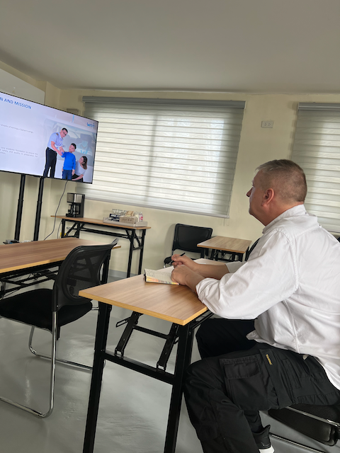
I enjoyed the first two days of ground school at Laminar Aviation. Why is it that one enjoys things like learning more when one gets old and does not really need it anymore?
On the first day our little group of students (2 new and 2 license conversions) got an orientation from Brian, the Chief Ground School Instructor, and a thorough briefing of the Safety Management. System of Laminar. The latter was done by Alison. The briefing was of a scope and quality I would have expected from a much bigger company. They take this stuff very seriously at Laminar.
Read the rest of this entry »
AIP, ATC, Chart, cross-country, flight plan, Maps, VFR
In Flight Bag, Knowledge, Navigation on April 8, 2014 at 2:23 am
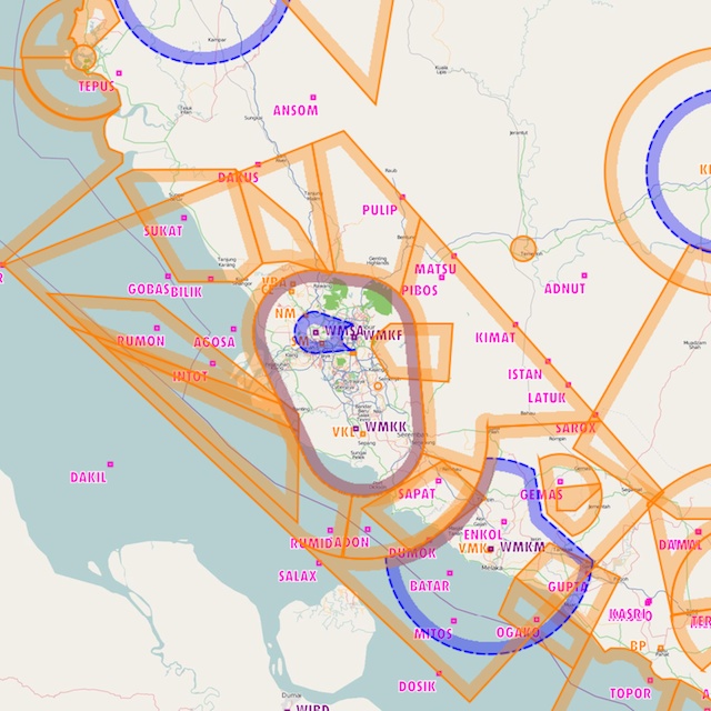
Airspace around KL International Airport in Malaysia
Have you, like me, looked with green envy at the navigation apps that are available to pilots in the US and Europe? The richness and accuracy of data and the functionality of these new applications is incredible. Unfortunately, literally none of this can be had for South East Asia.
As the readers of my blog will know, I have tried to rectify the lack of proper aviation charts for Malaysia with reporting point data and some self-created charts. The availability of applications on the iPhone or iPad with rudimentary support for Malaysian maps has improved the situation as well. But so far there is no application I am aware off that provides airspace information.
With this post I am giving you a little bit of the aviation chart heaven that our brethren in other countries have been flying in. Read the rest of this entry »
AIP, ATC, cross-country, flight plan, Reporting Points, VFR
In Flight Bag, Knowledge, Navigation on April 5, 2014 at 9:36 pm
I think I need glasses.
Singapore recently changed the reporting points between Seletar and Senai. The old “East of JB Town” is not in use anymore. Instead there is now an almost direct route via two new reporting points by the name of Tebrau City Mall and Felda Ulu Tebrau. Since East of JB Town is still the end point for VFR lane Delta, I left the waypoint in the file and added the new Waypoints with IDs XTEBR and XFELD.
VFR Reporting Points – Malaysia / Thailand / Indonesia – Version 140405
| AirNavPro |
Download |
Can be loaded into AirNavPro through the web server interface or into google Maps through the “My Places” interface |
| MotionX by Name |
Download |
Can be loaded into MotionX by sending the file in an e-mail or put it into Dropbox and use the “Open with …” function |
| MotionX by ID |
Download |
dito |
| For Print sorted by Name |
Download |
|
| For Print sorted by ID |
Download |
|
This picture below gives you an impression of the new routing, which is closer to the prohibited airspace WMP 228 (the one to the west that overlays NDB JB).
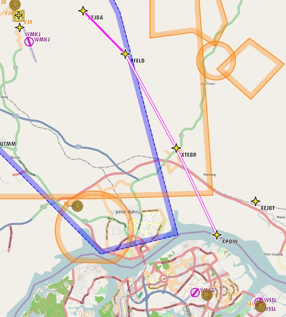
Routing from Seletar to Senai via new reporting points. (AirNav Pro screenshot)
AIP, ATC, cross-country, flight plan, Reporting Points, VFR
In Flight Bag, Knowledge, Navigation, Uncategorized on September 25, 2013 at 10:39 pm
So, where should I go next?
I have updated the VFR reporting point file. So far I have collected 137 points from the AIP (for example the VFR lanes or some of the special use airspace definitions) or by noting which points ATC would recognize.
If you come across any reporting points that are not included in my collection, please drop me an e-mail.
Read the rest of this entry »
airport, ATC, Batam, Changi Airport, cross-country, flight plan, Hang Nadim Airport
In Flight Log, Navigation, Social Life on September 21, 2013 at 5:25 pm
Rolling on runway 4 – Batam, Hang Hadim Airport
The Indonesian island of Batam is barely 10 nautical miles away from Singapore, but practically nobody ever flies there. I think there are three reasons for that. Firstly, the city of Singapore and the busy airspace of Changi Airport create a barrier between Seletar or Senai and Nadim Airport on Batam. Secondly, it is somewhat inconvenient to get a flight permit from the Indonesian DCA and thirdly, parking, landing and ground handling fees at Nadim Airport are rumored to be excessive.
My mission this weekend was to find out what it is really like to fly to Batam from Seletar Airport. (I had help from KC Lim, who occasionally flies with me while he is waiting for the DCA Malaysia to issue his SPL so that he can start his training.) (Please click here for more pictures)
Read the rest of this entry »
AFTN, airport, ATC, Bernam River Airfield, cross-country, flight plan, fuel, Ipoh, knowledge, Subang
In Knowledge, Navigation, Social Life, Weather on August 25, 2013 at 9:05 pm

Flying around the clouds at 4000 feet
I had a nice dinner with the Extreme Midlife Aerobatics team at a restaurant call Berliner’s , named after the city in Germany I am coming from. It was great to catch up with people who are as passionate about flying as I.
Graham told me that despite all problems they may have had, Bernam River Airfield is open for business. This will be one of my next flying destinations. Bernam River Airfield lies half way between Subang and Ipoh (it is included in my VFR reporting points list) and should be an excellent starting point for excursions into Pangkor, Penang or even Langkawi. I believe they have a few cabins for overnight stay. Given that Subang has become rather inconvenient for overnight stays, this little airfield is becoming attractive for weekend flyers.
Read the rest of this entry »
airport, cross-country, flight plan, fuel, Ipoh, Malaysia, Subang
In Aircraft, Navigation, Social Life on August 24, 2013 at 7:05 pm

Subang Airpark is going to be closed for small airplanes
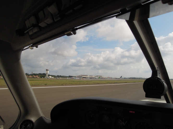
It was good to be back in the air today. For the first time I took the inland route from Singapore to Subang. That route shaves off about 10 minutes from the flight time. If everything goes according to plan, it is possible to fly from Singapore to Subang (block on/off) in about one hour and fifty minutes. In most cases it will be an honest two hours however. You have to watch you altitude however. There are some hills on the way that reach more than 1,500 feet. In my flight route some of the hills stand right in my flight path. (Download the flight log and AFTN Flight Plan here.) Read the rest of this entry »
ATC, aviation, cross-country, flight plan, fuel, Hat Yai, Ipoh, phuket, phuket airpark, thailand
In Flight Log, Navigation on August 12, 2013 at 1:02 am
Flight Summary
| Dates |
27 July 2013 – 31 July 2013 |
| Engine Time |
13h 10m |
| Landings |
7 |
| Airports |
WSSL, WMKP, VTSS, VTSW, WMKI, WMSA |
| Countries |
Singapore, Malaysia, Thailand |
| Distance |
approx. 1400 nm |
| Fuel total |
115 Gallons |
| Fuel per hour |
approx. 8.8 Gallons |
| Picture Gallery |
Click Here |
Read the rest of this entry »
airport, ATC, cross-country, flight plan, fuel, Hat Yai, phuket, phuket airpark, weather
In Aircraft, Airmanship, Equipment, Flight Log, Navigation on July 31, 2013 at 8:49 pm

9M-DRJ, a bit lonely at Hat Yai Airport, Thailand
On Monday, my short field take off skill was to be tested. In a case like this, before you do anything else, you have to makes sure the weight and balance of the aircraft is acceptable for the runway you want to take off. At a soft, grass field of 500 meters, that stuff really matters. Normally I take off from runways that are built for an A380, on which I have ample time to get up to speed or to abort if it is just not going to happen (the take off).
I couldn’t do much about my own weight (which is embarrassingly high these days), so I made my plane as light as possible. I had about 32 Gallons (87 Kg) of fuel and 25 Kg of luggage (mostly paper, iPad, laptop, handheld radio – this sort of thing). Altogether, I and my plane were in good shape for a short field take off. (I did the calculation for takeoff ground roll and over 50 feet obstacle as well, which is a topic for another post.)

W&B for take off from grass field Phuket Airpark
Read the rest of this entry »
ATC, cross-country, flight plan, fuel, Hat Yai, phuket, phuket airpark, thailand
In Airmanship, Flight Log, Knowledge, Navigation, Uncategorized on July 28, 2013 at 8:26 pm
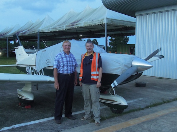
Pad James and Ingo at Phuket Airpark
Wow! What a day. The weather in Singapore turned a leisurely flight from Singapore to Phuket with plenty of breaks and buffer time into a mad race against time.
I arrive at about 7:30 am at the Seletar immigration checkpoint. The METARs and the rain radar didn’t look great, but there was still room for hope that I could take off between 8 am and 9 am. Later than planned, but still not too bad. A front of early morning thunder storms moved from the North West down the coast to Singapore, but hadn’t made landfall yet. I thought I could skirt the outer edges of the weather by flying inland rather along the cost to Malacca. By the time I had the aircraft ready the situation was still borderline acceptable, so I asked ATC for clearance. Surprisingly, they actually got it, but cautioned my that after Point XRAY the visibility would be so bad that I probably wouldn’t be able to proceed in VMC. If you have half a brain left, you do not ignore a message like that from ATC, so I postponed the flight plan to 10:00 am. Read the rest of this entry »